Why?
The GNIS (Geographic Names Information System) is the authoritative* source of information for place names in the United States. It is a fantastic dataset and despite the fact that there seems to be no reasonable way to get errors fixed–namely grossly misplaced peaks and elevation values–it has proven to be a valuable resource for cartographers. All of the features in the GNIS dataset are point features even if they represent features that are distinctly linear.
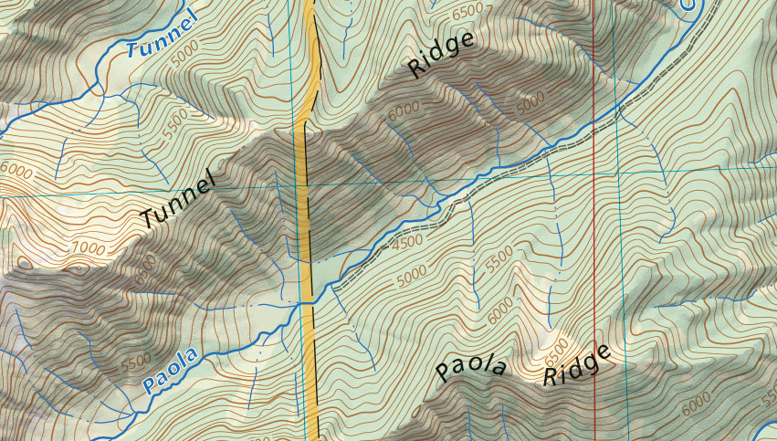
One of the things that I love about the original USGS topo 1:24k maps and I lament about the new US Topo products is the lack of feature labels on bézier curves that are now printed as straight block labels instead. I know that there are funding issues, usability issues, etc., but nevertheless, I hate to see this art fade away. For smaller features this isn’t quite as much of an issue, but for larger features like mountain ranges, a single point label on a particular quad is poor at best and quite misleading in my opinion.
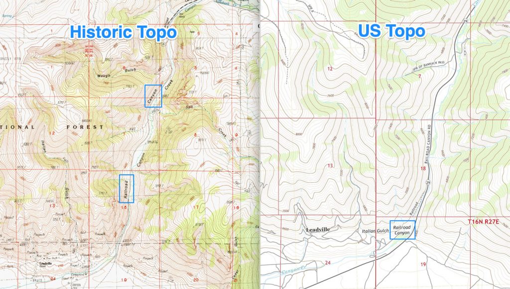
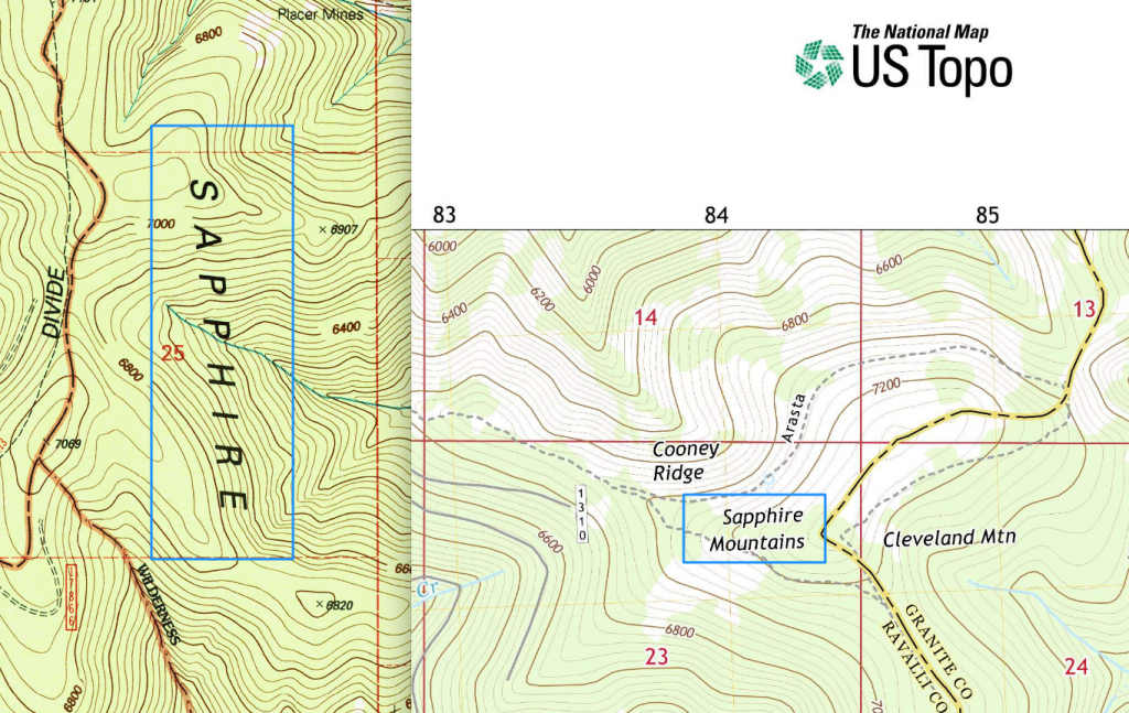
SO! What are we as enterprising cartographers to do to resurrect these great labels and use them for our modern cartographic work? Well, that’s what this project is all about.
The Project
This project aims to tap into the skills, time, and expertise of the cartographic community to build a rich, multi-scale dataset of these linear features. Together we can all work on a particular part of the country and then combine our efforts into a single dataset of linear feature labels. It carries an open source license and will be available in the public domain for all to use.
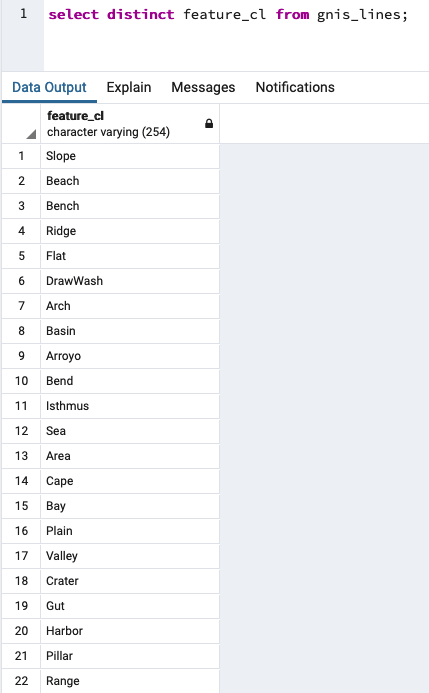
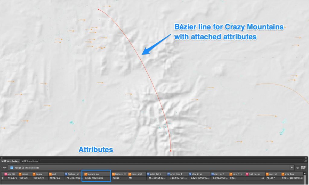
I’ve downloaded the GNIS point dataset and isolated the feature types that I think would benefit from being represented as a linear feature instead of a point feature. Mountain ranges are the obvious example, but other feature types including valleys, canyons, plains, and gulches are included as well. I’ve converted these selected point features into linear features and retained all of the attributes.
Help!
If you’ve made it this far, maybe you are the type of person that wants to contribute to the GNIS-Bézier project. Great! Let’s make this dataset together and make it free for everyone so we can all have better maps in our lives for years to come!
Step 1. Choose an Area
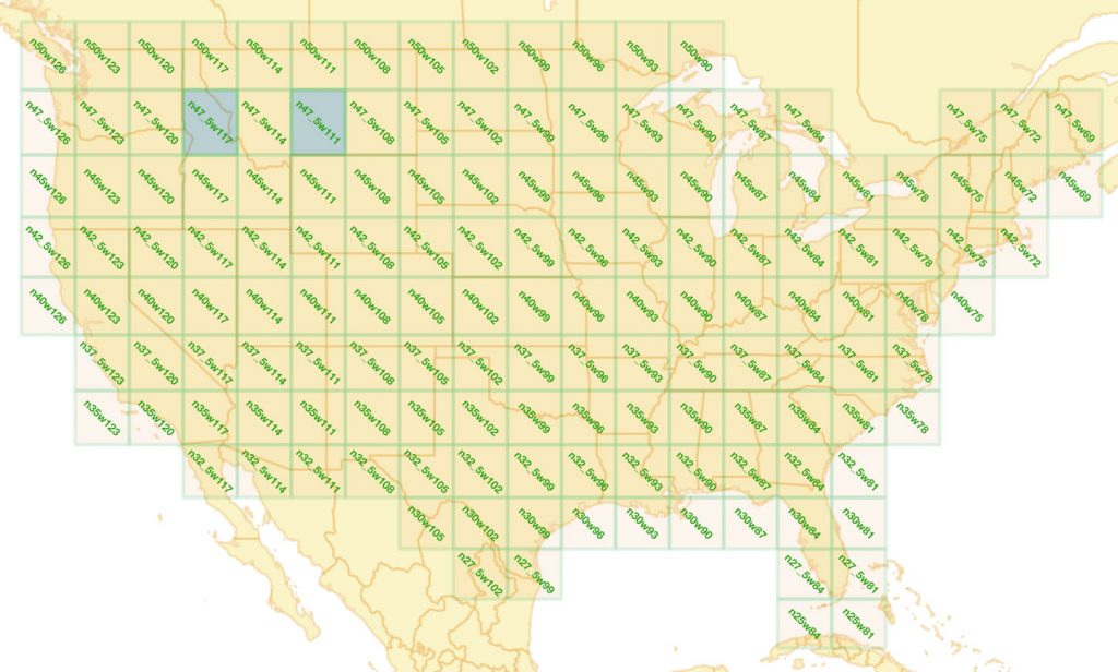
The first step to contributing to the project is to choose an area to work on. I’ve broken the country up into blocks that will allow for a ~360 square kilometer area to be worked on at a time. These constraints are based on the maximum artboard size that Adobe Illustrator supports when this area is displayed at ~1:50,000. Use the map below to identify an unclaimed block (click to enlarge). Any of the blocks below that are NOT filled with blue are unclaimed and up for grabs. Send me an email to jamierob @ gmail dot com to claim one. The Video below will help explain the data behind the project and choosing a piece of the country for you to work on.
Step 2. Download the data for your block
After you have your block, it will take me a little while to prep the documents for you. I have a semi-automated procedure that stitches together all of the original quad maps, de-collars and re-projects them, and then strips out a lot of the colors except for the relevant ones to placing the labels. The topo images and the GNIS-Bézier features are then put into an Adobe Illustrator document and ready to go. Once that is done I’ll post the files to the github project page and you can either download it or check it out. Don’t let a lack of git knowledge keep you from pitching in! Here is the repository if you want to check out the work so far.
Step 3: Edit the features
Once you get the features from me, you’re ready to get your hands dirty and move some lines. You’ll need basic knowledge of Adobe Illustrator, file management, and an attention to detail. There are some custom path scripts that really help to refine the bézier curves. An extension for Adobe Illustrator called MAPublisher is also required, but if you don’t have one–that’s ok–you can get a 14-day trial from Avenza and hopefully that should be sufficient for you to complete your block. The video below explains the procedure for downloading and editing your block of data in Adobe Illustrator. The basic steps to remember are:
- Edit the two nodes to make each line feature match the shape of the physical feature in question. Add new nodes as necessary but only if needed.
- Attributes – When the line is finished, update the ‘workstatus’ attribute for the feature as follows:
- x – The edit is complete and no other work is needed. It falls completely within the block being edited.
- q – you have a question about the feature. Someone else should take a look at it.
- e – The feature goes off of the edge of the block you are editing. When this feature is merged into the nation-wide document, this will need to be edited/fixed.
- Delete – If you think that the feature is just too small or silly to warrant an actual linear feature label, just delete the feature.
- Remember: These are very small illustrator files from a size perspective because they do not have embedded images or saved with PDF compatibility. If you try to save it with PDF compatibility checked or embed the images, it will probably choke.
Step 4: Submit your work back to the project
When you’re finished editing your block, either send the .ai file back to me or make a pull request and commit it via git. I’ll combine it into the full usa .ai document and we’ll slowly build up the dataset for the whole country. If/when all of the blocks are completed, we’ll have a single .ai document with bézier lines, with attributes for the whole country. We can assign map scale to features based on the line length and/or if the label text will fit on the line at a given scale. I haven’t quite sorted that part out yet. Finally, the dataset can then be exported out to other geodata formats so it can be used in other applications. The reason for starting in Illustrator with MAPublisher is to have the clean, bézier features first because when the features are exported (likely to shapefile), nodes will be added along the curves.
Thank you for reading and please consider working on a block if you’re interested! If you have any questions please post them below or send me an email.
*authoritative from a European colonization standpoint. The GNIS dataset contains place names from after Europeans arrived on Turtle Island and created names for these features. Many indigenous place names are not represented and some current place names are racist. I fully support efforts to rename these features to provide long overdue respect and recognition of the original names that were attached to these features.