GeoPhotos - A QGIS Plugin
Need for the Plugin
I’ve always relied on geotagged photos for some of my field work, but have never had a solution that worked exactly the way I wanted it to, so I built one myself! I wanted to have a folder full of all of my photos–pretty unorganized–and have them all display as clickable photo links in QGIS and be easy to update. My workflow is to use the Solocator app (no affiliation) on my phone to take photos when I’m in the field, dump them to a single folder on my Synology NAS, and then have a table of points in QGIS that is a comprehensive layer of all the photos i’ve ever taken.
Functionality Requirements
- Read a directory of photos, find all photos with valid lat/long and EXIF data, create a geopackage of points for each photo and populate this table with all relevant data.
- Works with subdirectories as well, and have a single button to refresh/update the geopackage when new photos are added to the folder
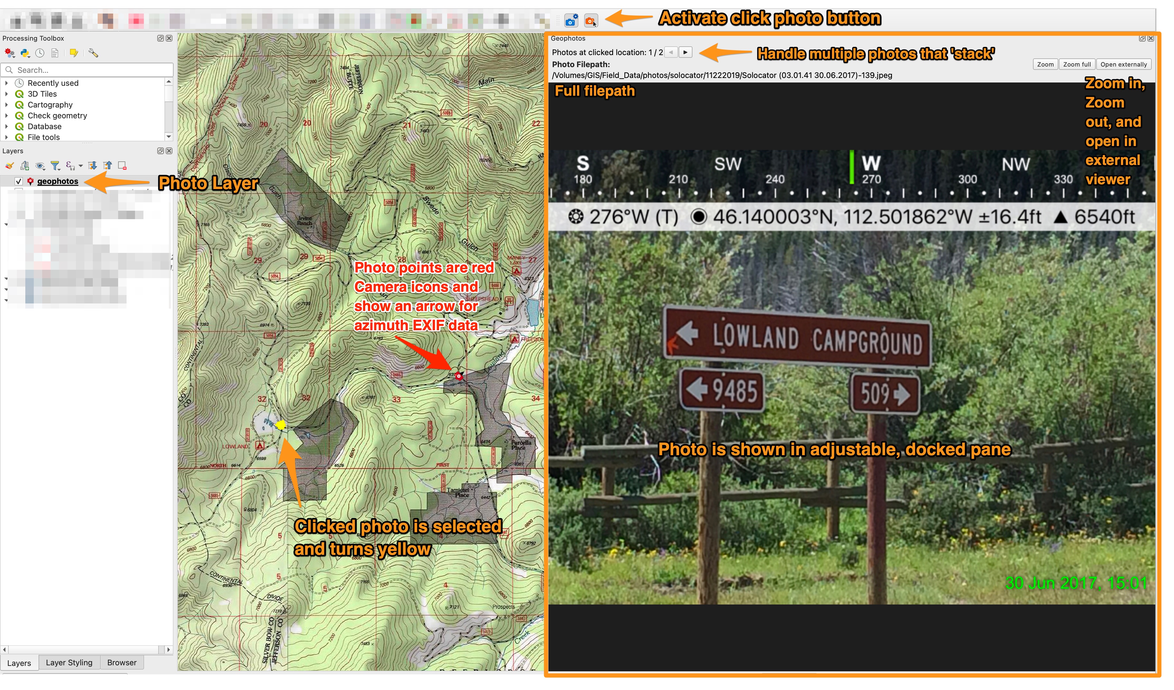
- Photo viewer is a fixed, docked window in QGIS (not an external image viewer)
- Be able to zoom in on the original image to read fine detail/text in photos and optionally open the photo in default image viewer
- Filter the table of photo points by a date range
- Handle clustered photos that overlap spatially and be able to click/view multiple photos when they are captured with the same/similar lat/long
- Be able to select a set of points on the map and export those photos easily without having to parse through the whole photo directory manually.
Installation
- From the QGIS Plugins repository, search for ‘GeoPhotos’ and install it.
- Optionally, access the code at the repository here
Usage - Settings
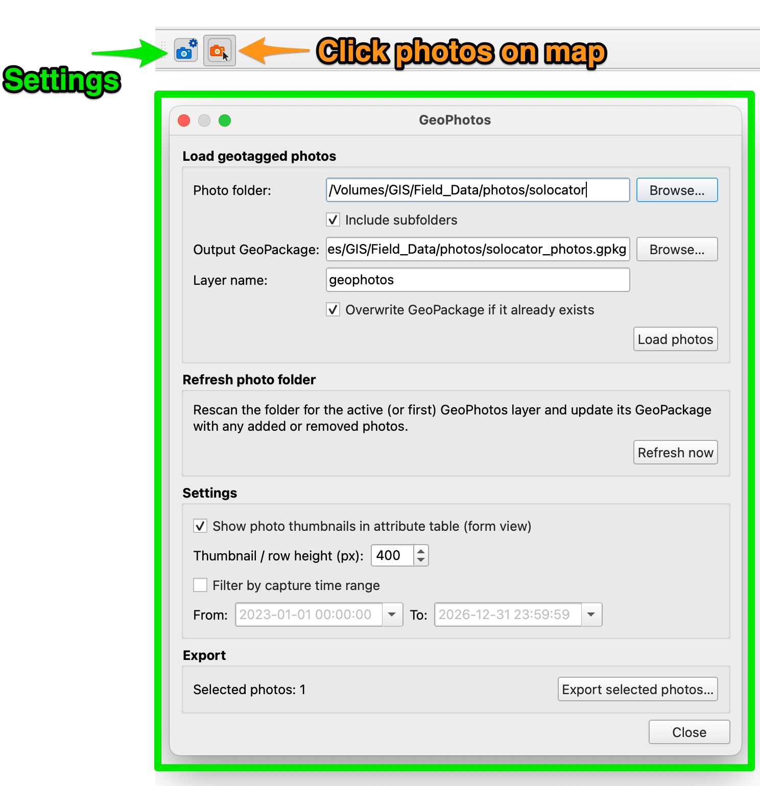
The usage is very simple–just two buttons on the toolbar: settings, and click photos. In settings you choose your folder of photos, choose your output geopackage location, and set the layer name. Click load photos to search the folder and create the geopackage.
Other settings include:
- Refresh/update the geopackage when new photos are added to the folder
- Make the ‘path’ attribute display photo thumnails in the form view of the attribute table. Useful in conjuction with the ‘show features visible on map’ attribute table filter option to make a list of photos in a particular area on the map and view them all quickly without clicking individually on each photo point.
- Filter the whole photo layer by a date range
- Export photos for the points selected on the map
Usage - Click Photos
Select the photo layer, activate the click photo button, and then click on a photo point to display the photo.
- Photo is shown in fixed, adjustable pane
- If multiple photos are ‘stacked’ on the map, click through them quickly in the same pane with the arrow buttons
- Zoom in on the full resulution, original image to see fine detail and read text in the photos. Optionally open in the default OS image viewer.